|
Contributed by Robin McLachlan, PhD student at University of Washington 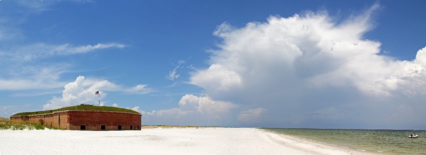 West Ship Island is the home of Fort Massachusetts, built in the 1860s. The island is now a popular tourist destination where visitors can fish, swim, and tour the fort. PHOTO: Roger Smith, flicker http://bit.ly/2lPZOny Barrier islands refer to offshore deposits of sand that run parallel to the mainland. They are vital buffers between mainlands and the ocean’s harsh wind and waves. “Mississippi barrier islands are the first line of defense between the Gulf of Mexico and the Mississippi mainland, and are an important habitat for threatened Gulf Sturgeon, endangered and threatened sea turtles species, and threatened shorebirds” (Dalyander et al., 2016). In 1852, the “Great Mobile” hurricane tore through Ship Island in the Gulf of Mexico splitting the single island into two pieces, East Ship Island and West Ship Island, and it hasn’t been able to fully recover in the wake of several hurricanes since. The Army Corps of Engineers and other Federal and State agencies made a plan to restore Ship Island by filling the cut in between East and West Ship Island with sand, effectively suturing the island back into one whole. By filling in the breach with sand, the island would be bigger and more stable, and, thus, better at protecting the Mississippi Sound from waves in the Gulf of Mexico, cutting back on the amount of sand filling in the Gulfport navigation channel, preserving the salinity variations in the Mississippi Sound, and serving as habitat for endangered and threatened fish, shorebirds, and sea turtles. But a big question stood in the way of restoration: what if a storm damaged the barrier island while the restoration process was underway? A team of scientists answered this question by using structured decision-making to settle on a course of action in the face of a storm and multiple, conflicting objectives during each stage of the restoration process. When making a decision about what to do if there was a storm, the researchers had to consider the two things they could run out of: sand and money. They found that if the storm was really big, the sand that could be washed away and lost would be devastating for the recovery project, so more money should be spent to ensure success of their primary goals. But if the storm was small, they probably wouldn’t run out of available sand and the island would likely remain stable, so it would be best not to spend more money. This project showed that adaptive planning frameworks that can inform management every step of the way are valuable when we work in dynamic environments, like barrier islands, that can change drastically while the restoration project is underway. With these frameworks, we can save time and money while still preserving these vital environments. West Ship Island is the home of Fort Massachusetts, built in the 1860s. The island is now a popular tourist destination where visitors can fish, swim, and tour the fort.
PHOTO: Roger Smith, flicker http://bit.ly/2lPZOny Original article can be found here: http://www.sciencedirect.com/science/article/pii/S0301479716306442 Can't access the original article? Find out more details about this article on our database: http://www.opensciencedb.com/federal-agency-research-db.html#federal-research-db/medical-research-db-detail/58c89c374096c02a30e902a8/ |

|
|
|
